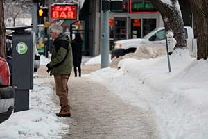
The official snow depth at the Missoula airport stood at 15 inches this week, marking the first time since 1996 the city had that much snow on the ground at any given point.
Corby Dickerson, meteorologist with the National Weather Service, said Missoula has recorded 39.9 inches of snow this season – two inches above average for an entire winter.
“We’re already 2 inches above normal for an entire winter, and we aren’t even halfway through January,” Dickerson said Friday. “We’re ahead of normal and will have an above-normal winter.”
The average snowfall for December is typically around 11 inches, though Missoula received just shy of 28 inches this December. Snowfall from January through May generally averages 21 inches.
If the rest of the winter is average, Dickerson said, Missoula stands to record nearly 60 inches of snow this season, or roughly five feet.
“It’s been 20 years since Missoula has seen this much snow in the city itself,” Dickerson said. “It’s the first time we had a snow depth of 15 inches or greater since 1996.”
The cold temperatures – subzero at times – has kept the valley snowpack in place. The average temperature in December was 5 degrees below normal. So far this January, Dickerson said, the average temperature in Missoula is 16 degrees below normal.
Snowfall records also are being tested in other categories this winter. From Dec. 9 to Jan 9., Missoula recorded nine days with snowfall over 1 inch.
“The last time we had that amount was 2008 when we had eight days with snowfall over an inch,” Dickerson said. “In 1996, we had 11 days over an inch. It wasn’t one storm in 1996, but it felt like it because it snowed for 5 days in a row. This is the snowiest it has been since 1996.”
Back in early December, Nick Silverman with the Montana Climate Office at the University of Montana forecast near normal temperatures in western Montana with a slight increase in precipitation.

His winter forecast was based on a weak La Nina setting up in the Pacific Ocean. The phenomena remains in place, and Dickerson said predictions suggest it will linger for a little longer.
“We expect La Nina to remain in place,” said Dickerson. “The Climate Prediction Center just released their latest findings. It will be designated as a weak La Nina, but La Nina nonetheless.”
While the Missoula Valley is above average in snowpack, the mountains surrounding the valley are running at around 80 percent of normal. Dickerson attributed that to the recent arctic air that has sapped moisture from the snow.
The cold temperatures should ease as the wet weather returns.
“We anticipate more wetter winter storms than what we’ve seen,” Dickerson said. “It could be mixed with some rain. We’re evaluating what areas might be susceptible for that.”
Flooding or ponding remains a concern.
“There’s no prolonged areas of warm temperatures or precipitation,” Dickerson suggested. “The biggest concern in the next seven to 10 days with any rain potentially causing issues is that a lot of the storm drains are covered up with snow right now.”
Contact reporter Martin Kidston at info@missoulacurrent.com